towns are different; I will show examples in a moment. Note that
in [19] there is a track at lower left, labeled “To East Shumala.” The
map is done this way partly to suggest that East Shumala is some
ways away from the town depicted in [19], but partly also because
it physically lies about perpendicular to Shumala on the layout,
thus not being geometrically convenient to be represented in a
map like [14].
That in turn means that a separate map in the timetable was pre-
pared for East Shumala. That area is itself simple to represent, but
as stated, the separate map helps convey some conceptual dis-
tance. This strategy could be used on many layouts. My map for
East Shumala is shown in [20], and here open boxes instead of gray
rectangles are used for structures (partly as an experiment relative
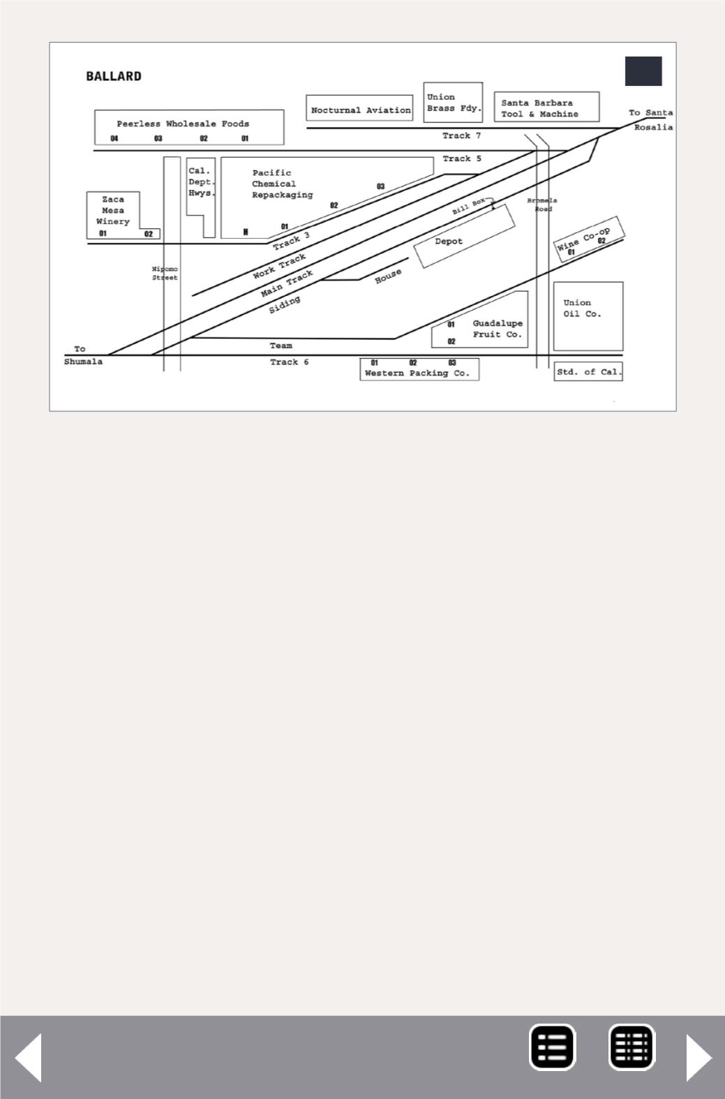
21. My current map of Ballard, which is still undergo-
ing occasional revision. Not only are there a number of
industries here, but many have multiple spots. These
are called out on most waybills. If the specific spot is
not designated on the waybill, crews would receive
direction from the local agent or from a plant foreman.
21


