Getting Real Column - 15
ink, similar to [10.] Almost as soon as the [10] map was completed
(some years ago), there were needs for changes, not readily done
on this inked drawing version.
One of my newmaps is shown in [19], for my town of Shumala.
(This is an actual Chumash Indian place name from the area.) Note
the stylistic similarities to both of the SP maps shown in [16] and
[18], though of course I do not show any numbers for tracks or
switches, since those were assigned years after my 1953 modeling
era. This is a Photoshop map; a test to see if I liked this map style.
The map does not show railroad structures such as the round-
house (to the left of the turntable [19]), because in and of itself,
that’s not a switching destination. But the machine shop at the left
rear of the roundhouse, as the map shows,
is
a switching location.
Likewise, the sand house and the “SP Fuel Spot” are where sand
and locomotive fuel are unloaded for use at this engine terminal.
This particular map only has one instance where specific spots are
identified, at the Associated Oil Company bulk dealer. But other
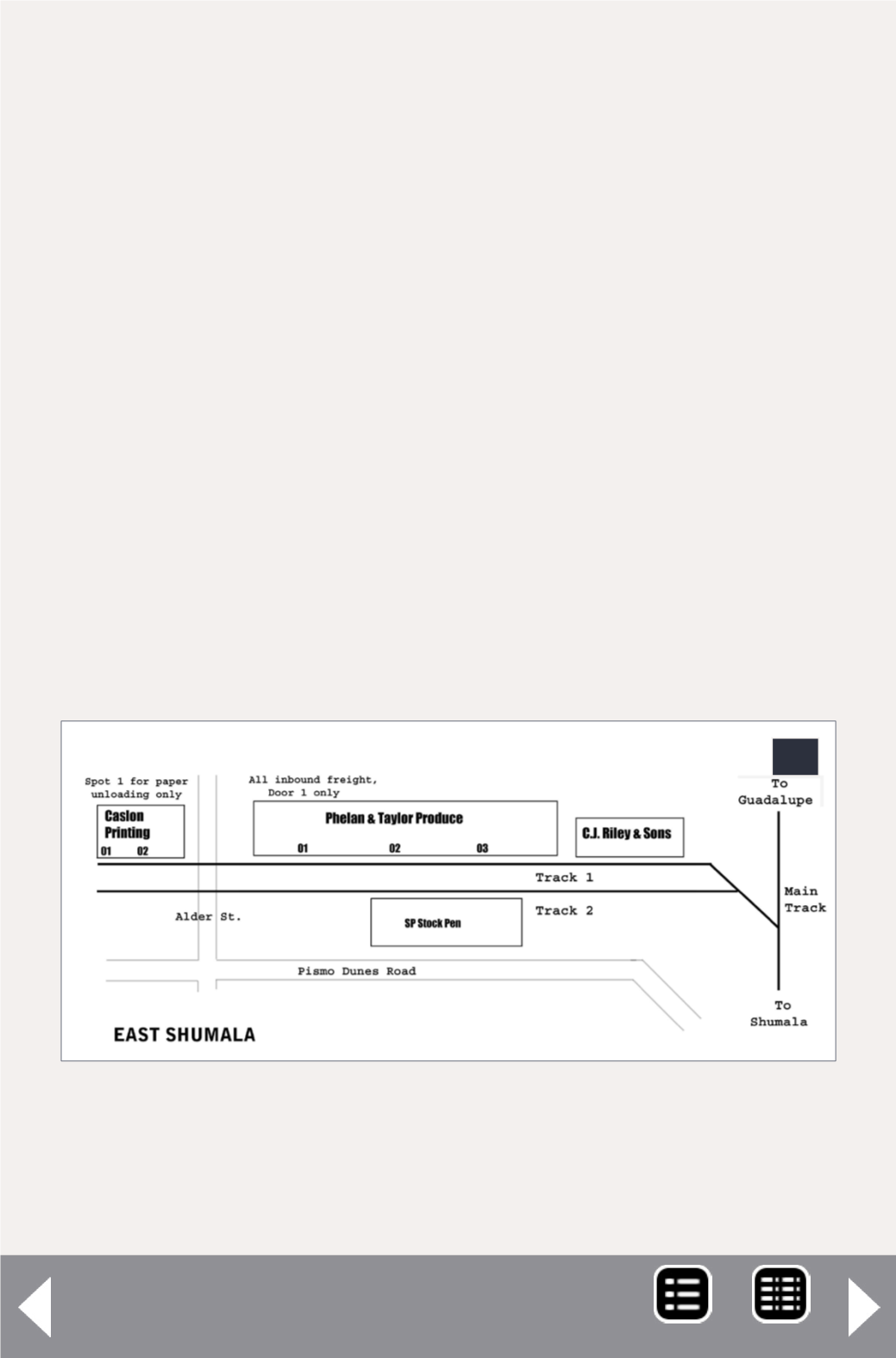
20. Map for the layout timetable of the location called
East Shumala. Here there are specific spots at two of
the industries. Surface roads are also shown, as this
helps operators locate specific points.
20
MRH-Oct 2014


