Computer-generated backdrops - 4
Add trees, detailed shrub objects
Add clouds
Adjust lighting (Sun)
Render full resolution views, rotating camera.
Stitch views into single image
Finalize image in image editing software.
Large-format printing
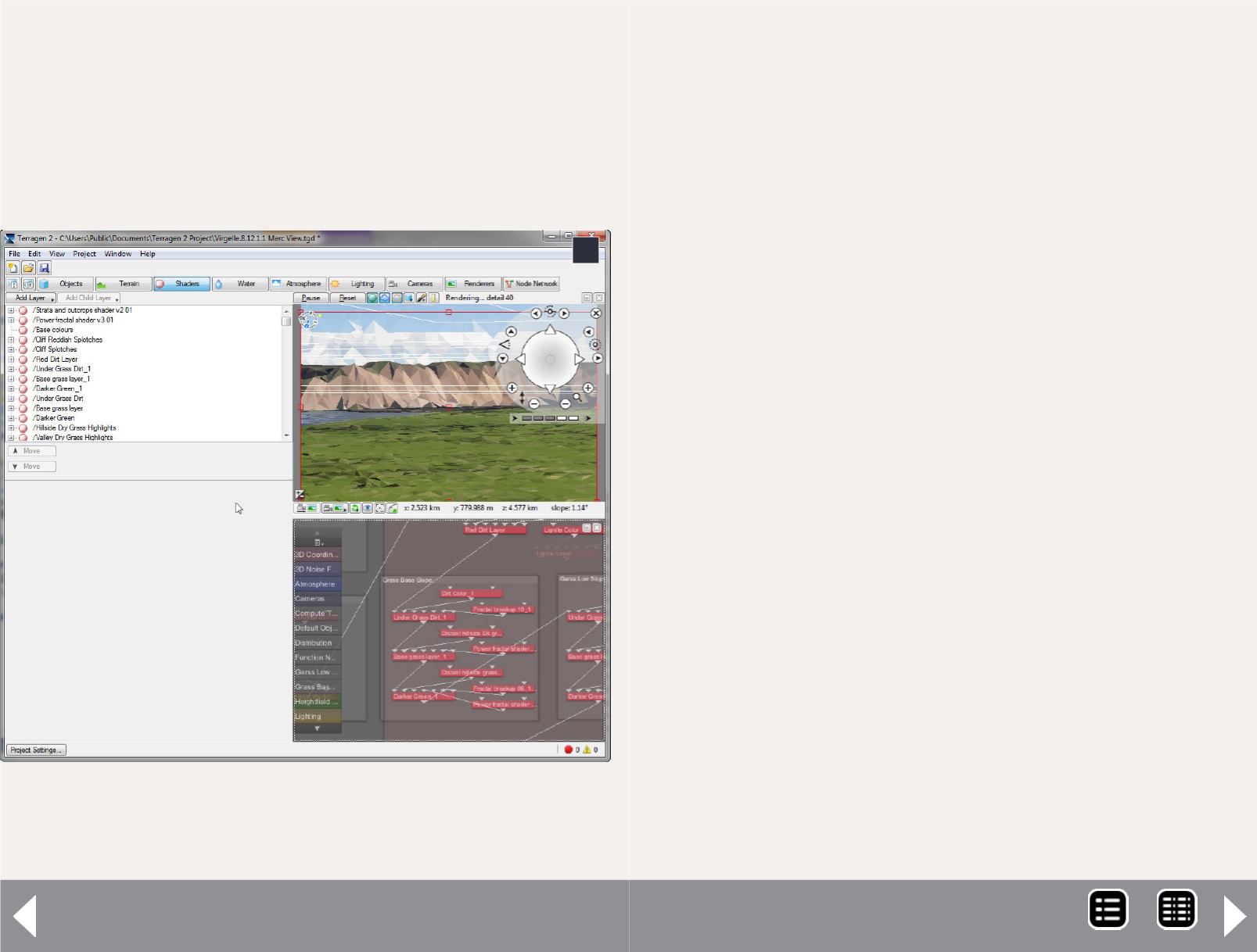
4. This screen capture of Terragen shows the outline
view, the network view, and the low-resolution preview
view of the simulated image.
4
The starting point of a scene is the bare terrain, which is a
virtual location bound by length and width with topography.
Terragen can generate a terrain for your scene using fractals
that may be adjusted to create virtual geographies from rolling
prairie to steep mountains. An alternative approach I used is to
download digital elevation model (DEM) data provided by the
USGS. (See resources- USGS Seamless Server)
This allows you to create a scene using the actual elevation
data from satellite measurements. If you are modeling a pro-
totype location as I am, you can build a scene with nearly the
exact terrain of the actual location.
The scenes I am modeling include sprawling Montana vistas
with mountains over 25 miles away on the horizon. The UGGS
data I sampled included an area of over 1000 square miles with
an elevation data point at least every 30 feet. Terragen easily
handled these vast scenes.
The next element to set up is positioning a camera in your vir-
tual world. If you are using fractal-generated terrain, you will
want to wander around your scene seeking out a view that is
pleasing and will fit your layout location. If you cannot find a
suitable location, you can enter a new random number into the
fractal and Terragen will generate a new world for you.
If you are using USGS DEM data, you will likely have a bet-
ter idea where to position your camera. As you consider your
camera position, think about how a person is viewing your
railroad foreground relative to the background scene. My lay-
out is a double-deck shelf layout, so the viewing perspective
of the top scenes is nearly eye level. In this case I positioned
the camera height at 20 feet inside the Terragen model. This
correlates to how high my eye level is above the layout. For
MRH-Jul 2014


